Part Two: Soleimani and the Battlefields – A General Without Borders (Section Four)
 Political Section
Operational Maps and Comparative Graphs
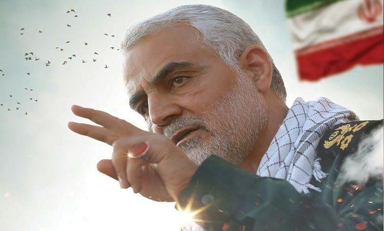
Martyr Haj Qasem Soleimani was among the most distinguished field commanders in the region, whose courage and dedication, combined with a deep understanding of strategic equations, made him a unique model in designing and leading multi-layered operations. His keen attention to detail, along with precise use of analytical tools and modern technologies, transformed the battlefield into a room for intelligent decision-making, and his operational maps became a clear and progressive language for the resistance.
Operational maps and comparative graphs were among the tools he extensively and purposefully used to design strategies and advance complex operations. These tools enabled him to manage battles with a comprehensive and multi-dimensional vision and make precise and effective decisions. This section examines the role of these tools in Haj Qasem’s operations, their methods of use, and their impact on field successes.
Role of Operational Maps in Strategic Decision-Making
Operational maps held a central place in Haj Qasem Soleimani’s military activities. These maps were not merely geographical tools to display locations; rather, they functioned as multi-layered analytical systems containing diverse information, including:
-
Geographical and locational data: Maps accurately depicted operational areas, including terrain features, access routes, and strategic points. For instance, in the liberation of Amerli (Iraq, 2014), Haj Qasem’s operational maps included the precise locations of ISIS bases, supply lines, and areas controlled by resistance forces.
-
Logistical information: The maps marked supply bases, weapon depots, and transportation routes. This helped field commanders identify the enemy’s logistical weaknesses and design strategies to cut supply lines.
-
Enemy behavior analysis: Haj Qasem used past intelligence data to predict enemy movements. Maps with precise markings displayed recent enemy movements, troop concentrations, and even their relocation patterns.
-
Environmental conditions: Factors such as weather, time of day, and seasonal changes were considered on the maps to anticipate their impact on operations. For example, in the Al-Qusayr operation (Syria, 2013), analyzing weather and terrain aided in designing infiltration routes for resistance forces.
These maps were designed so that commanders at various levels could quickly extract the information needed to make decisions. Haj Qasem combined a holistic battlefield vision with attention to tactical details.
Comparative Graphs and Data Analysis
In addition to operational maps, comparative graphs were another key tool in Haj Qasem’s strategies. These graphs were designed to analyze and compare data across time and space, providing valuable information to commanders. Key applications included:
-
Analyzing enemy movements: Time-based graphs showed enemy movement rates, troop numbers, and changes in their combat capabilities over specific periods. For example, in Al-Bukamal (Syria, 2017), comparative graphs demonstrated the gradual decline in ISIS’s logistical capabilities due to sustained attacks by resistance forces.
-
Assessing own forces’ capabilities: These graphs compared operational capacities of resistance forces across different areas, recording troop numbers, weaponry, and advancement rates to identify strengths and weaknesses.
-
Predicting future trends: Using past data and pattern analysis, comparative graphs helped forecast enemy behavior and probable operational outcomes. This was especially vital against mobile terrorist groups like ISIS and Jabhat al-Nusra, which had unpredictable patterns.
Typically presented as line or bar charts, these graphs allowed rapid and accurate comparisons of variables. For instance, a graph could show the rate of resistance forces’ advances relative to enemy withdrawals over time, which was useful for adjusting subsequent tactics.
Utilizing Modern Technologies
A prominent feature of Haj Qasem Soleimani was his use of modern technologies alongside traditional methods.
He employed specialized teams for data analysis and field simulations, using tools such as:
-
Geographic Information Systems (GIS): These software integrated spatial data to create multi-layered maps, enabling simultaneous analysis of multiple variables (troop positions, weather, and logistics routes).
-
Field simulations: Technical teams modeled various operational scenarios, helping Haj Qasem identify potential weaknesses and design alternative strategies.
-
Intelligence data analysis: Information from various sources (satellite imagery, field reports, and espionage data) was processed to extract accurate patterns of enemy behavior.
This integrated approach, combining technology with field experience, allowed Haj Qasem to make rapid and effective decisions in complex operations like the liberation of Mosul or Deir ez-Zor.
Impact of Maps and Graphs on Operational Success
The use of operational maps and comparative graphs had a profound impact on the success of Haj Qasem’s commanded operations, including:
-
Enhanced decision-making accuracy: Access to precise, analyzed data shifted decision-making from intuition-based to data-driven, minimizing tactical errors.
-
Improved coordination among forces: Maps and graphs served as shared tools for commanders and field forces, enhancing coordination across different operational units.
-
Threat anticipation and prevention: Graphical analyses identified potential threats before they occurred, crucial in counter-terrorism operations.
-
Resource management: In conditions of logistical constraints, these tools helped optimize resource usage.
In conclusion, operational maps and comparative graphs for Haj Qasem Soleimani were more than technical tools—they became part of his command philosophy. By integrating field data, modern technologies, and multi-layered analyses, he transformed warfare from a reactive process into an intelligent and predictive one. These tools enabled him to make precise, rapid, and effective decisions across the most complex battlefields, from Amerli to Al-Bukamal.
Haj Qasem’s approach to using analytical tools and modern technologies elevated field victories beyond mere tactical success, creating a lasting model for strategic management amid crises. His creative and multi-dimensional vision not only reshaped the battlefield but also illuminated the path for future commanders and analysts.


